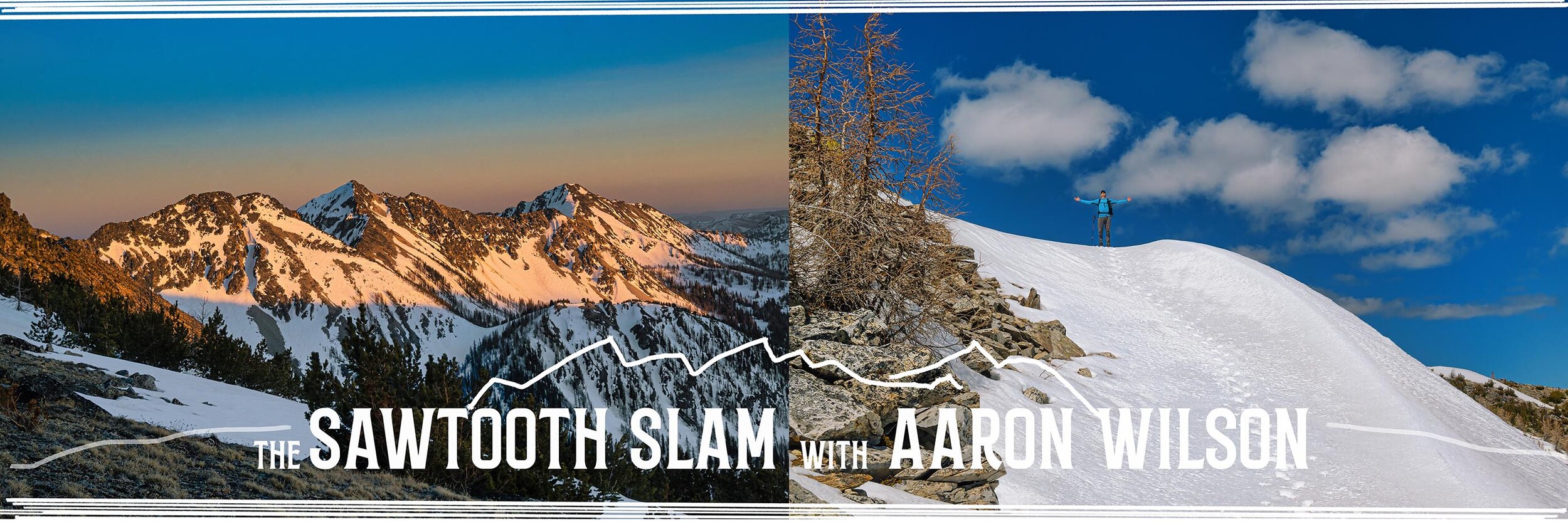
The Sawtooth Slam with Aaron Wilson
Preface. Something a little bit different.
This post is completely about me and my friend’s two day trip to tackle 9 mountain peaks. SPOILER ALERT- I do make a poor decision and end up stuck on some scary terrain. Now, if the sound of that doesn’t trigger a record spinning to the tune of Queen’s “Don’t Stop Me Now”, well this trip report may not be for you.
I am lucky to have Aaron as a mountaineering buddy and to have spent quite a few days in the mountains with him over the last year. I think we have summited something like 18 peaks together so far. He planned this trip and invited me along. Below is his written report which is jam-packed full of details of the route, our decisions along the way, and photos documenting the trip.
Highlight video reel
So here it is, the trail report and photos by Aaron Wilson
The Chelan Sawtooths are an area that have always intrigued me, but due to the long drive time from where I live (5 1/2 hours each way) I had never visited. I had some time off for Memorial Day weekend and weather forecasts through out the state made this an easy choice for an overnight trip in late May. I got in touch with Ross, and he was game for the Sawtooth Slam (Switchback, Martin, and Bigelow) plus more if we had time. We decided on a 4:30am meet up in Wenatchee where we carpooled to the trailhead. By 6:20 we were hiking.
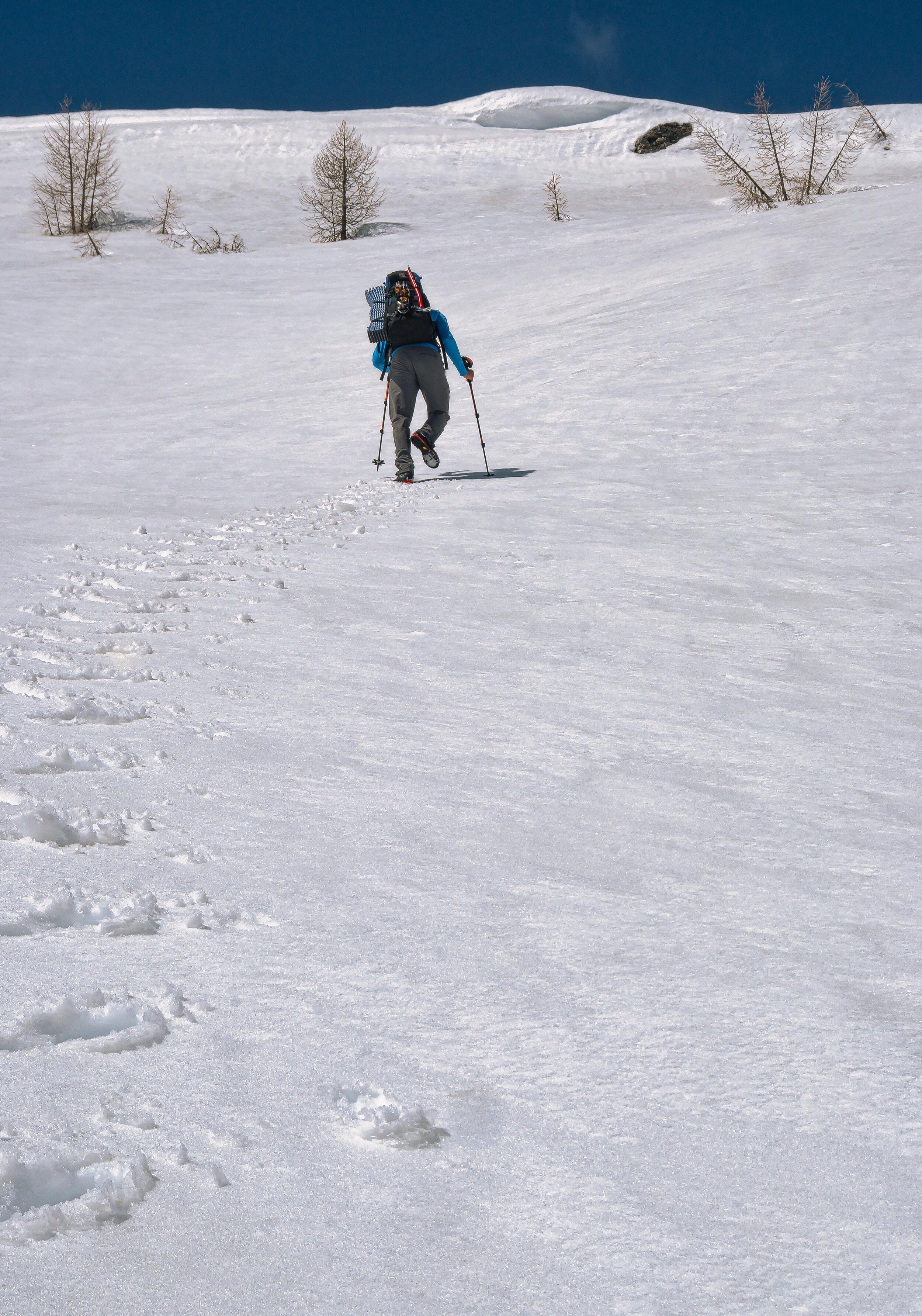
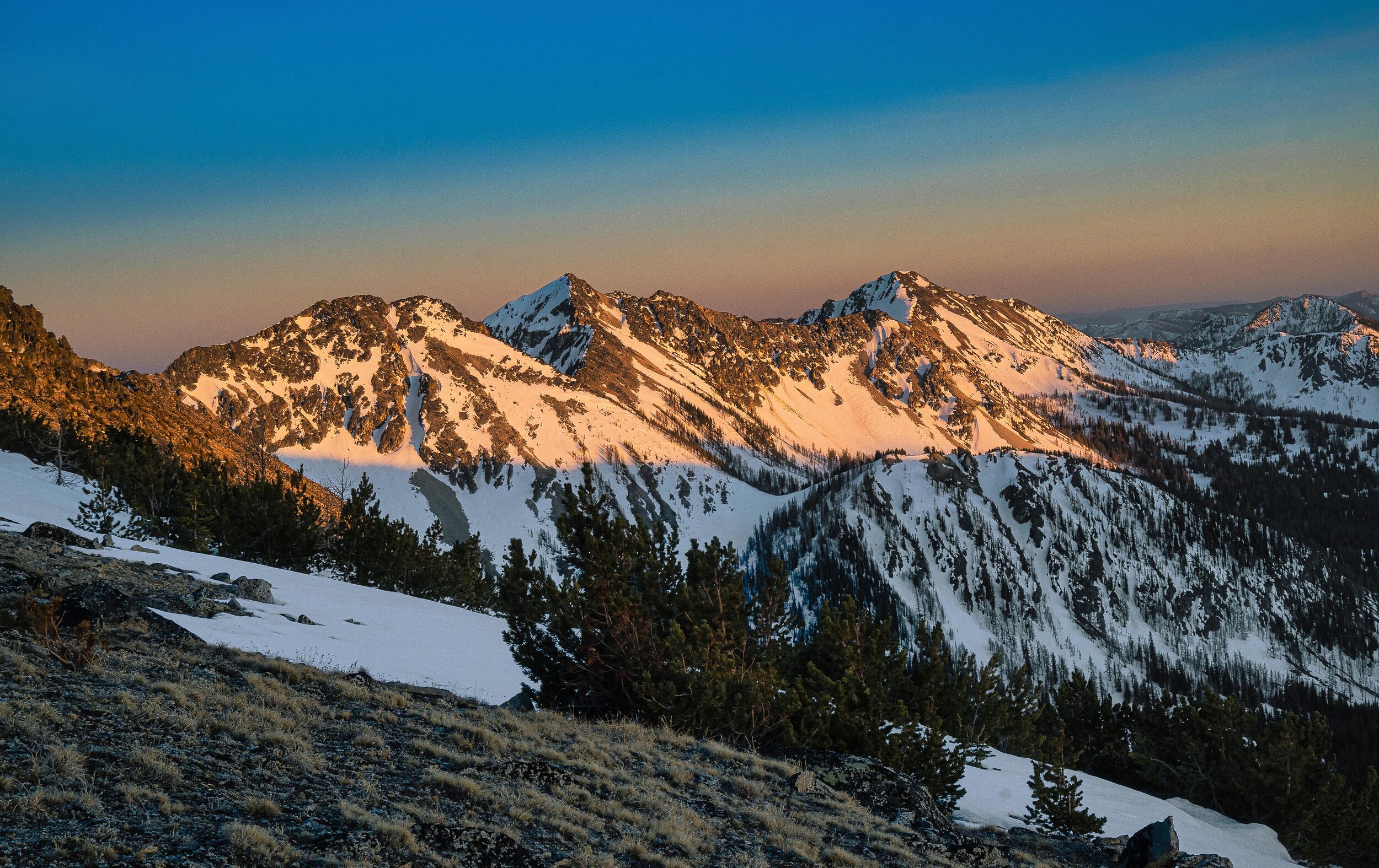
I gotta say, it was really nice to start the trip in trail runners! The first few miles of the trail were pretty easy and a good warm up. We took the trail towards Cooney Lake and soon came across a high flow stream crossing. After some searching up and down stream a hundred yards or so we decided on a shoes off ford. It was only ankle deep, but man was it cold! I'm a cold weenie when it comes to my feet and it was a little painful, but I soon recovered and we were on our way. Patchy snow became continuous around 5800 ft and we switched from trail runners to boots. Thus far we had been following tracks in the snow and soon came across the people responsible for those tracks, a couple guys on their way back from Martin Lakes. They had gone up for some fishing but found the lakes still frozen over. I figured once we passed the turn off for Martin Lakes we'd be on our own for route finding and trail breaking and that turned out to be the case. We navigated up to the saddle leading to Cooney Lake. Snow thus far was fairly well consolidated with occasional mild post holing. We found ourselves a little north of the lake, rather than at the east / south side where the summer trail goes. We decided to take snow up to the saddle north of Swithchback since it was much closer at that point than the standard SE ridge route. (Below photos by Aaron Wilson)


Let’s hit the peaks
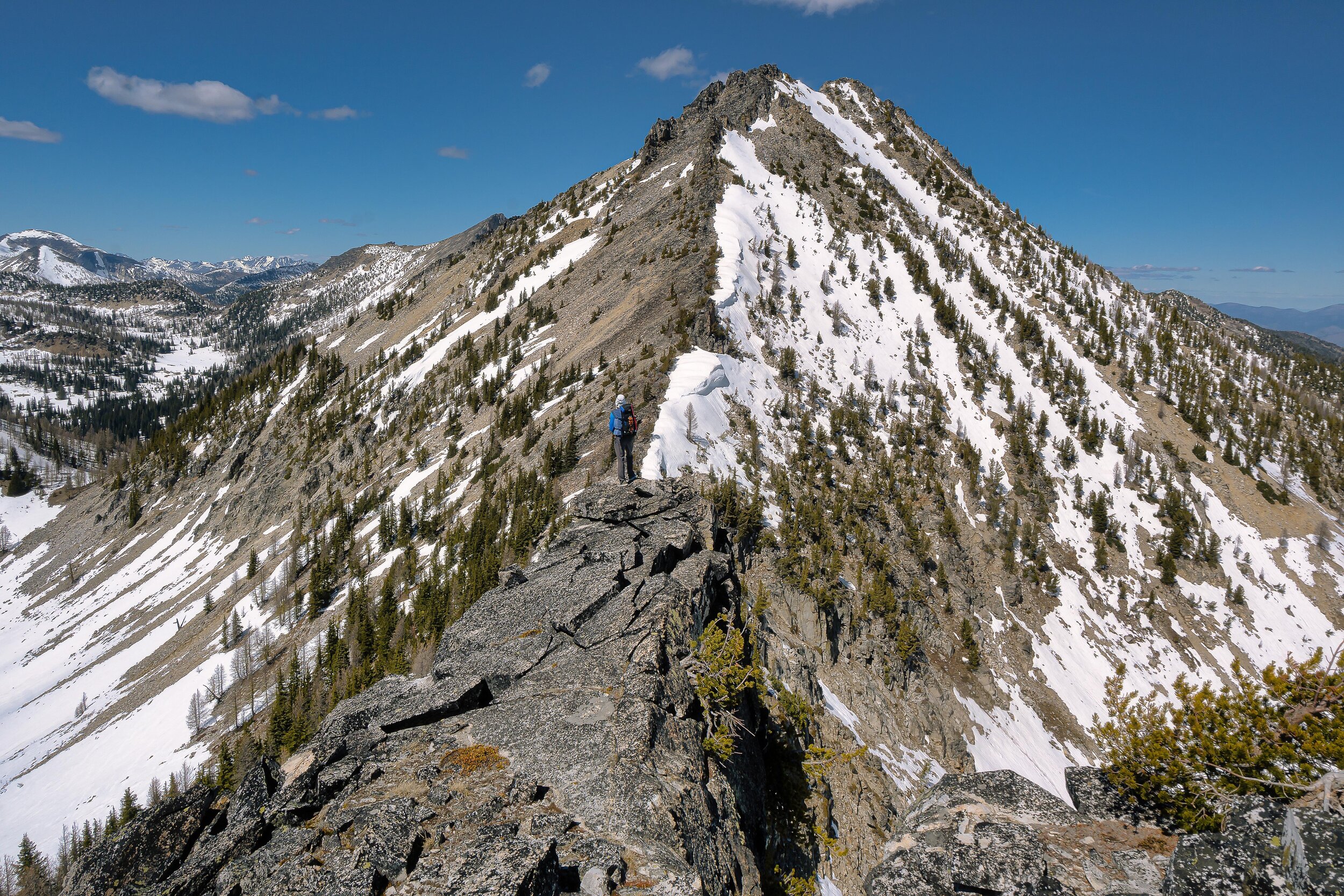
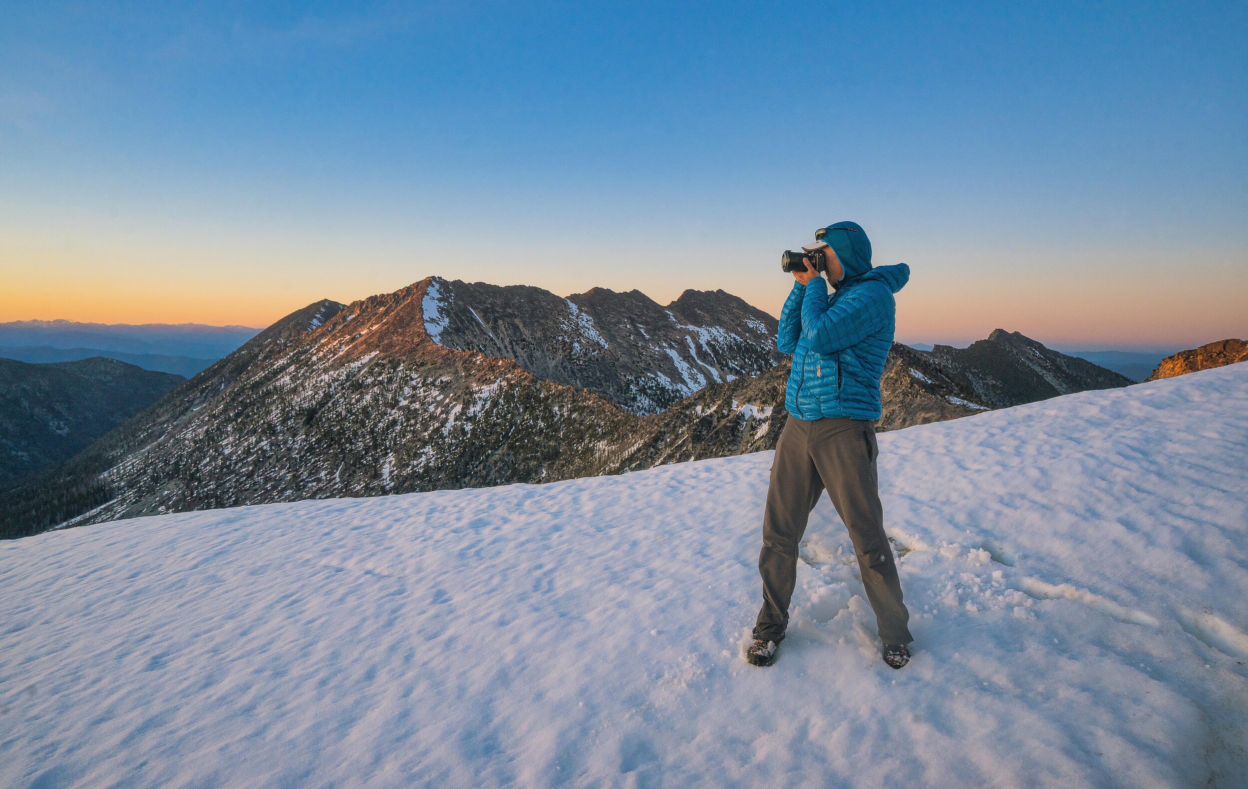
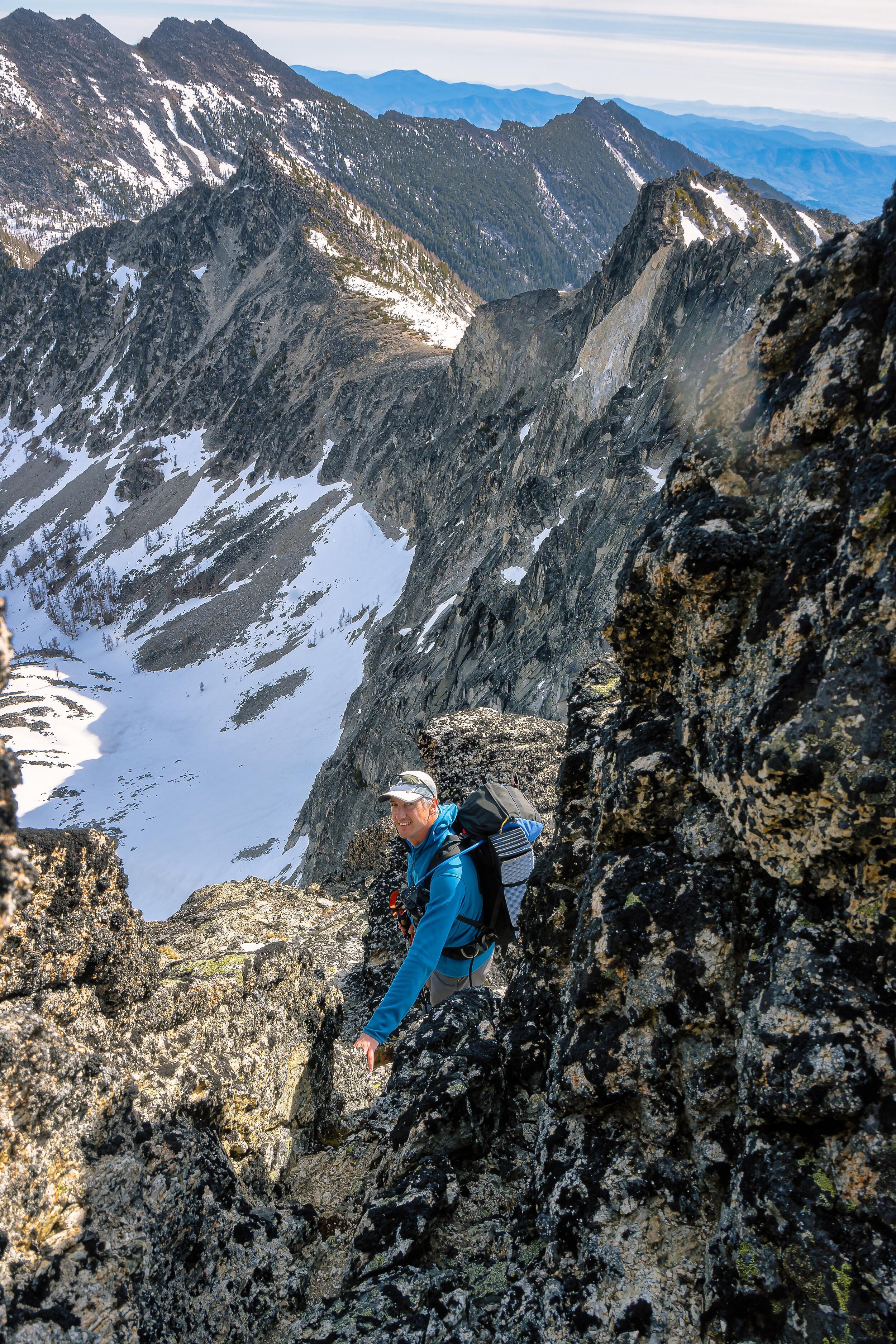
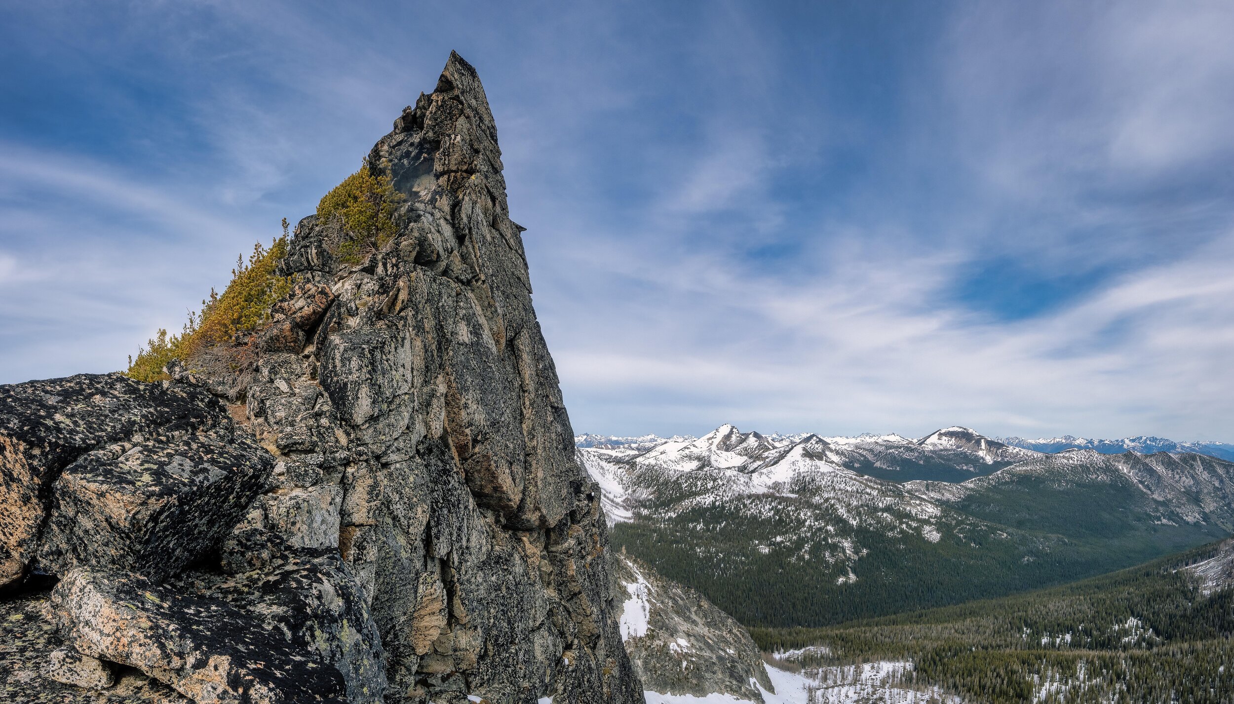
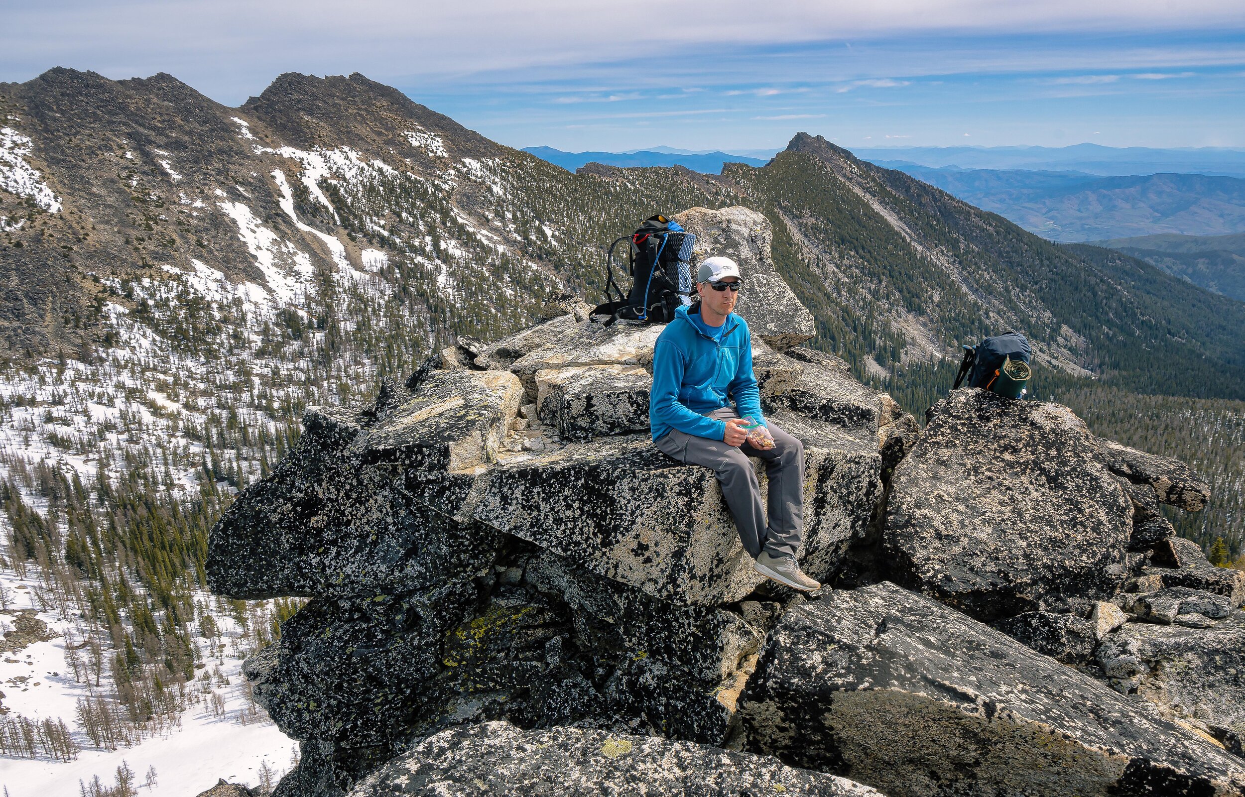
Up at the saddle, we ditched our overnight packs and continued on with our pack lids. Neither of our pack lids had straps long enough to use as a backpack, so we took off our belts and used those. Ross had his on like a fanny pack, and I used a shoulder sling approach. Neither were terrible comfortable, but tolerable for a short trip to the summit. Great views from up there! It was cool to see familiar peaks from a different perspective. We didn't stay too long, returned to our packs and headed on towards Martin. On point 8068 we switched from boots to trail runners and were much better on the scrambly terrain of the ridge. Martin wasn't too bad, mostly class 2 up talus, maybe a couple class 3 moves but pretty easy. I was starting to feel pretty tired at this point. I was willing to skip Cheops and head straight for a camp somewhere and some rest! I pulled out a salted watermelon energy gel which really was a game changer for me for some reason, maybe the sodium / electrolytes? From that point on I felt fine the whole rest of the day. Weird... Anyway, after Martin, things got interesting. (Below photos by Aaron Wilson)


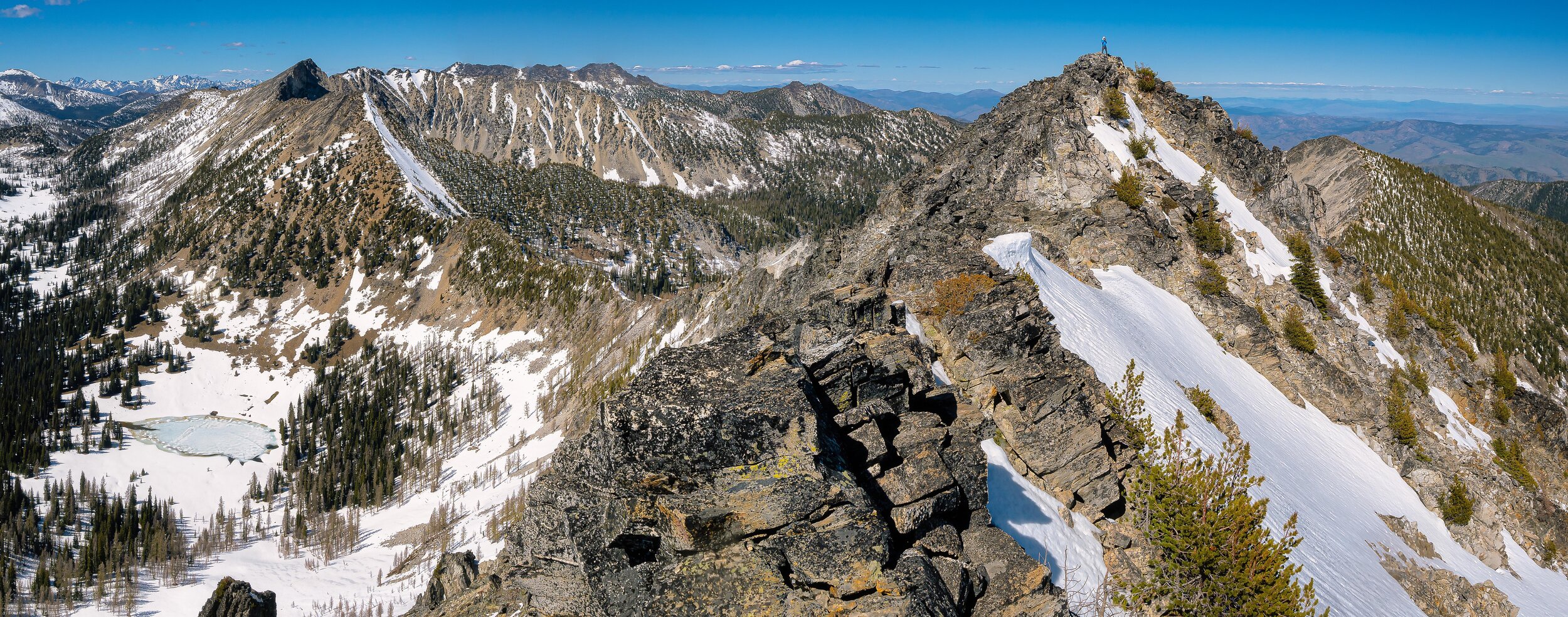
Descending from Martin was a bit more scrambly than I was anticipating. Not that it was all that difficult, but a bit tedious and frequent use of hands to assist with downclimbing moves. We made our way to the Martin and Cheops saddle. The east side of the ridge looked like difficult terrain with cliffy areas towards the top complicated by snow, so we scoped out a line traversing out onto the southwest slopes a bit, and up to the summit from there on mostly talus and boulders. There was a small false summit with the true summit not too far away from that. Great views up here too! Oh, there were ladybugs everywhere on pretty much every summit. Sometimes it was a bit difficult to find a hold or foot placement that wouldn't squish lady bugs! On the summit we began to discuss where we'd camp for the night. We decided against the standard Boiling Lake camp since that would leave several hours of wasted daylight. We thought about camping around Hoodoo Pass, but what we finally settled on was camping on the northwest shoulder of Bigelow, just below the summit block. From Cheops it looked like a broad flat ridge and I suspected we could find a spot to bivy up there, but I really had no idea if the terrain would be suitable for a bivy. There was one way to find out! We began our descent of Cheops, but then things got a little spicy. (Below photos by Aaron Wilson)


Stuck between a rock and a steep icy slope
Ross and I had a moment of poor communication. Both of us, looking down the northwest slopes of Cheops thought a snow descent might be appealing. The upper half of the mountain was mixed cliff bands and snow while the lower half was pretty much all snow. I had discussed heading down the west ridge and then contouring onto the snow when it looked like it would be smooth sailing and Ross said he wanted to change into his boots first. I stayed in my trail runners and started down the west ridge. When I was down a couple hundred feet I look back up and Ross is heading right for the first available snow. I see him try a glissade, only to hit a rock and have to recuperate. Then he starts heading straight down into the snow and cliff bands. I really didn't want us to get separated, so what was I to do? Well, I guess I'm heading into that mess too! I got on my boots and pulled out my axe and got onto the snow. The snow was awful. Rotten sloppy punchy snow with a talus field beneath. I traversed a steep section onto a rocky band and made contact with Ross. We were separated by a gully and another cliff back but we could talk and decided we'd both continue straight down from where we were. I was able to stay on rock and choss for a bit before being forced out onto snow again, more horrible rotten snow where every step was a thigh deep post hole. Eventually I maneuvered over to a section with good run out and glissaded down a couple hundred feet until I was below the cliff bands. I look back up, but no sign of Ross. I could hear an occasional rock tumble so I knew he was on the move, and then I see a large black object go flying down the mountain and slam into the base of the cliffs.
Ross was dressed all in black and it made my heart jump for a second before I realized it was his backpack. He threw it down the mountain to make his descent easier. Soon I see him on some cliff bands trying to find a way down. I suggested a line based on what I could see and he made it down, although he likely had some class 5 moves to get out of the jam he was in. Soon we were back together and heading down towards boiling lake. FYI the northwest face of Cheops is a horrible descent route. Not recommended at all. Fortunately the snow down to Boiling Lake was much more consolidated and easier travel. I gave Ross the option to just camp here to recuperate from that last adventure, but he was eager to continue so we did. We briefly chatted with two guys camping at Boiling Lake, filled up on water, and headed towards Bigelow. (Below photos by Aaron Wilson)


Finding a spot to sleep
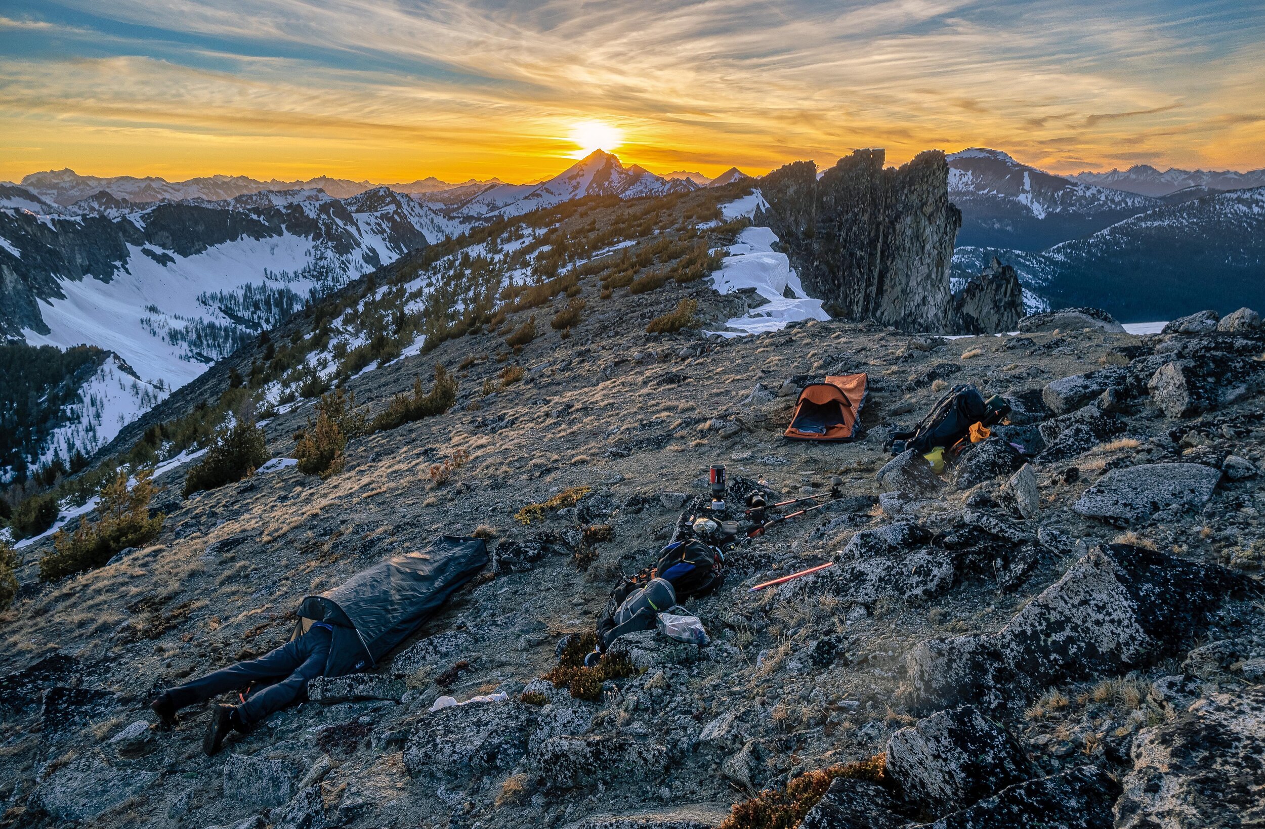
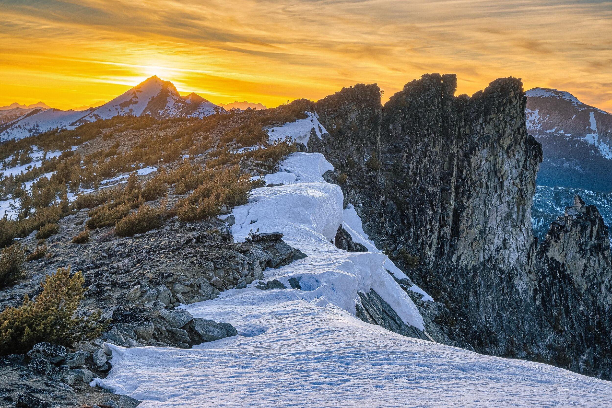
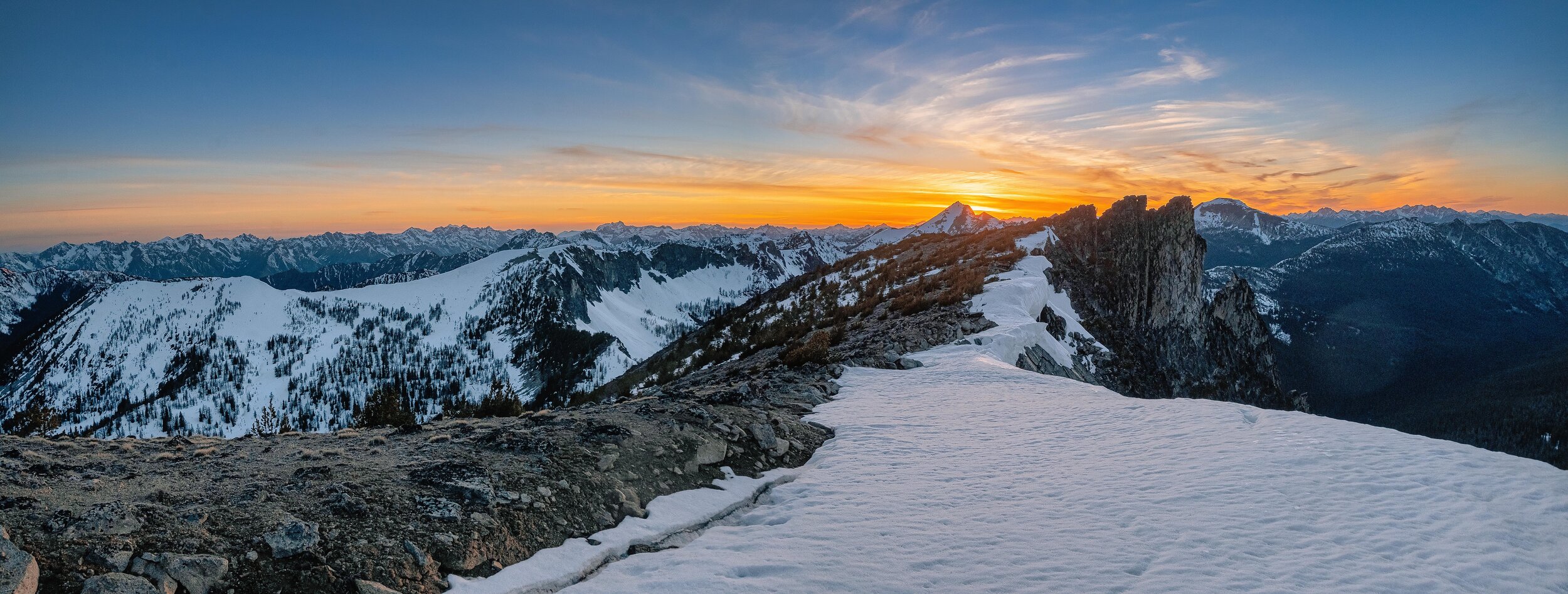
We did a rising traverse for the ~8100 saddle northwest of Bigelow's summit. It was hard to stay on course and not go straight up the boulders towards the summit. I had a lot more energy at this point and was ahead. Ross suggested I go on ahead and scope out if our bivy idea was going to work. I powered on ahead for a bit and soon Ross was out of sight. I decided I'd really rather not get separated again so I just waited until he caught up. It was slow going the last little bit. Our backup plan if there was no spot to bivy up there was to head back down to Hoodoo Pass and find a spot there, but sunset was fast approaching and I came to grips with the fact we'd be bivying up there whether we were comfortable or not. Fortunately there was a decent spot to bivy up there. Not really room for a tent, but we found a couple spots for our bivies that were actually quite comfortable. Sunset was great! Nice color in the sky, but between getting my bivy ready and cooking dinner photography was almost an after thought, but here's some pics. (Below photos by Aaron Wilson)


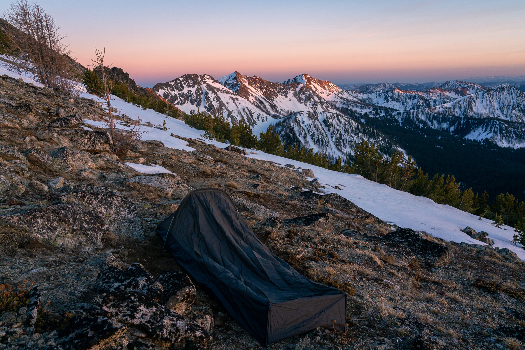
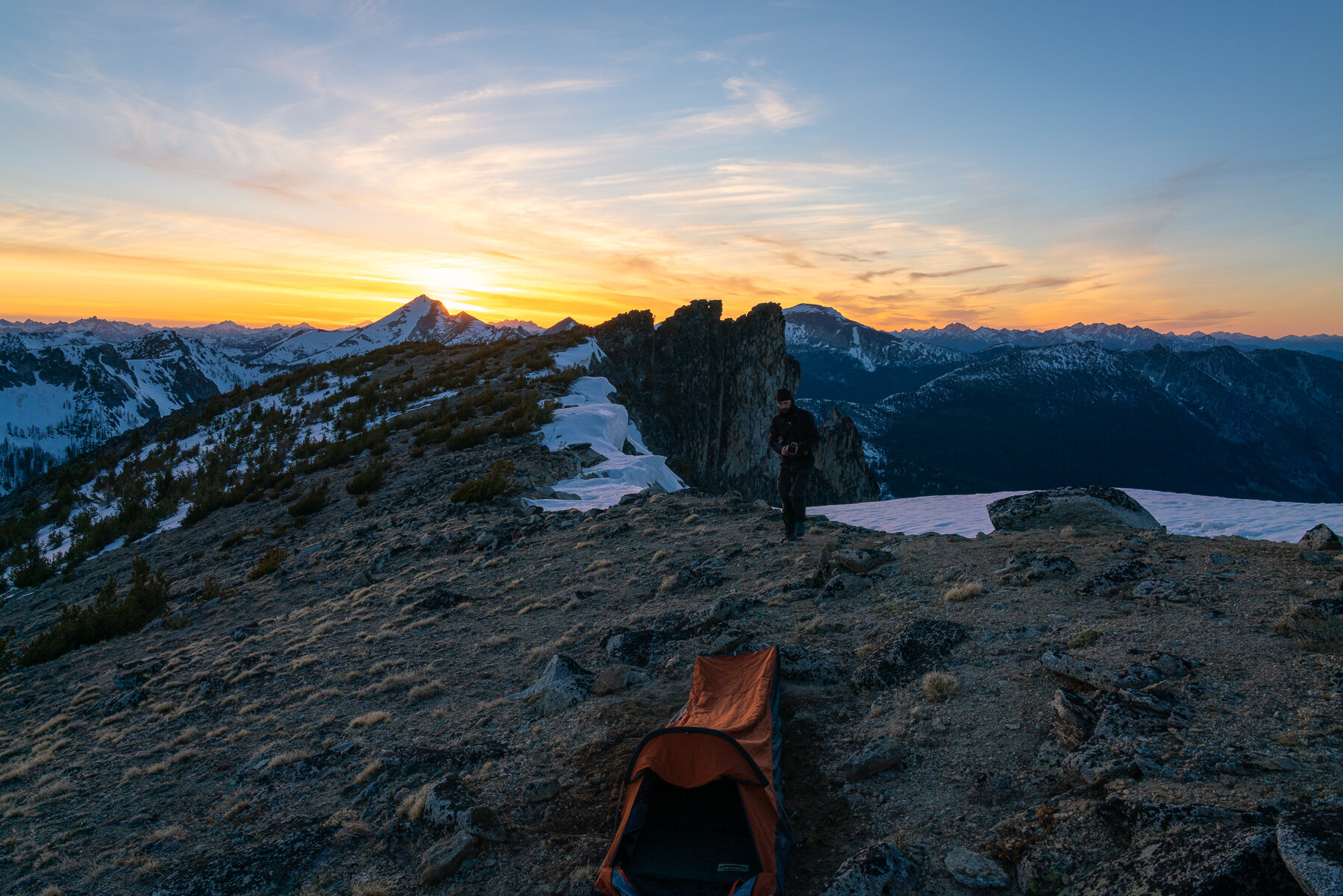


A well deserved night of sleep
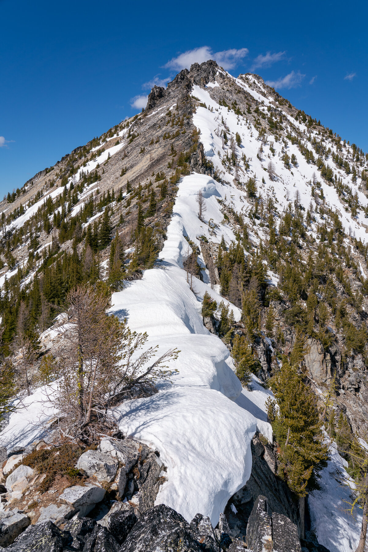
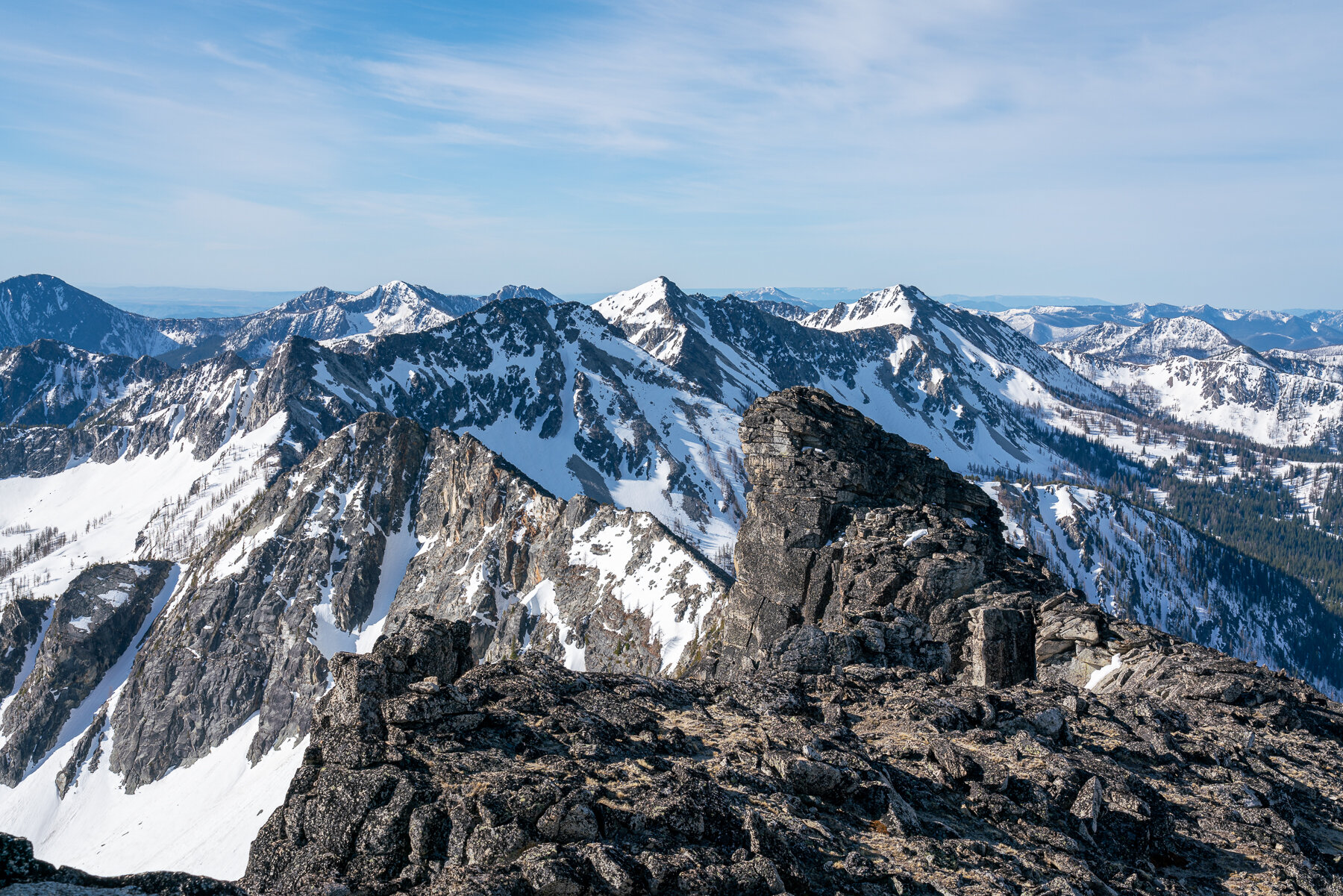
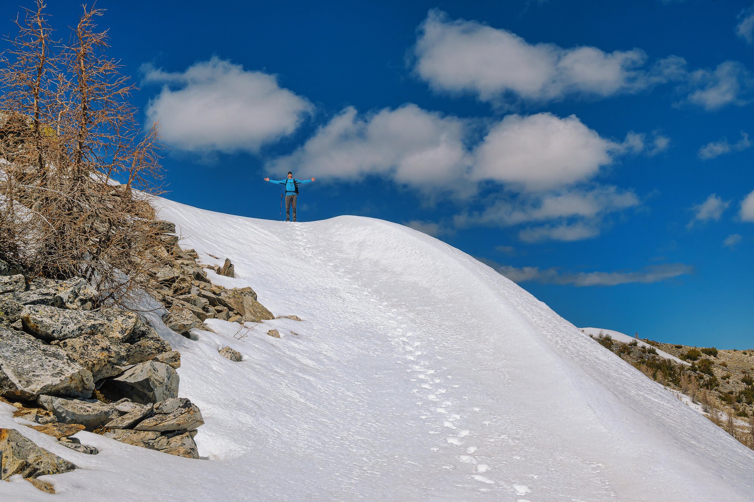
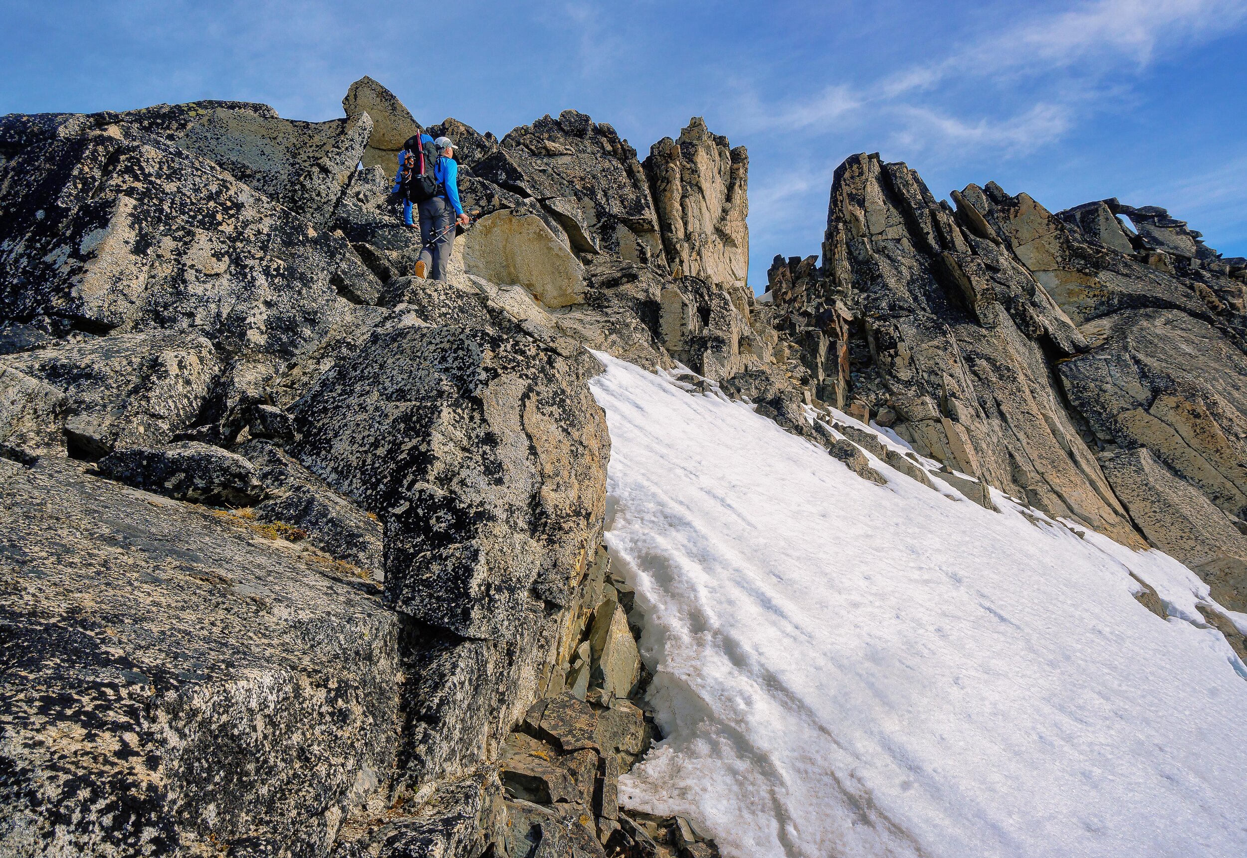
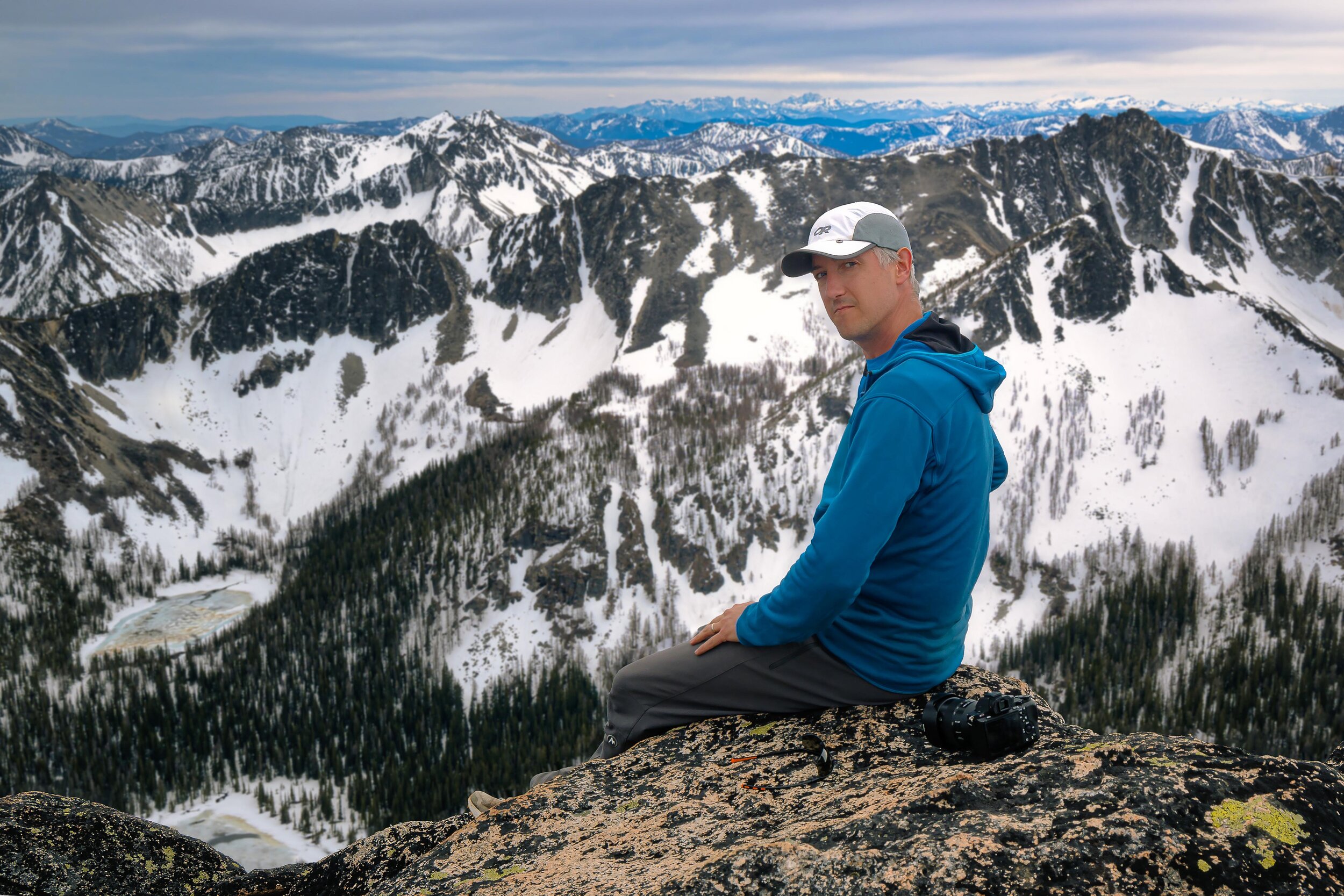
We were both glad to snuggle into our sleeping bags that night after a 14 hour day bagging peaks with a full overnight pack on. We set an alarm to get up for sunrise if it was going to be good, but when the alarm rang the sky was boring so we slept in until 6:15. Man it felt good to get some sleep. We ate breakfast then packed up and headed for Bigelow. It went quick since we were camped only a couple hundred feet below the summit. Great views from up there too, and the only summit register of the whole trip of all the peaks we were on! We had more than enough time to add on more peaks, and naturally Libby / Raven Ridge would be the next goal. To get there, I've seen some groups drop down to Hoodoo Pass, then down to 6600 ft and climb up from there. We decided to give the NE ridge of Bigelow a try since it would save 1000ft elevation gain or more. It turned out to be a bit more involved than anticipated! (Below photos by Aaron Wilson)


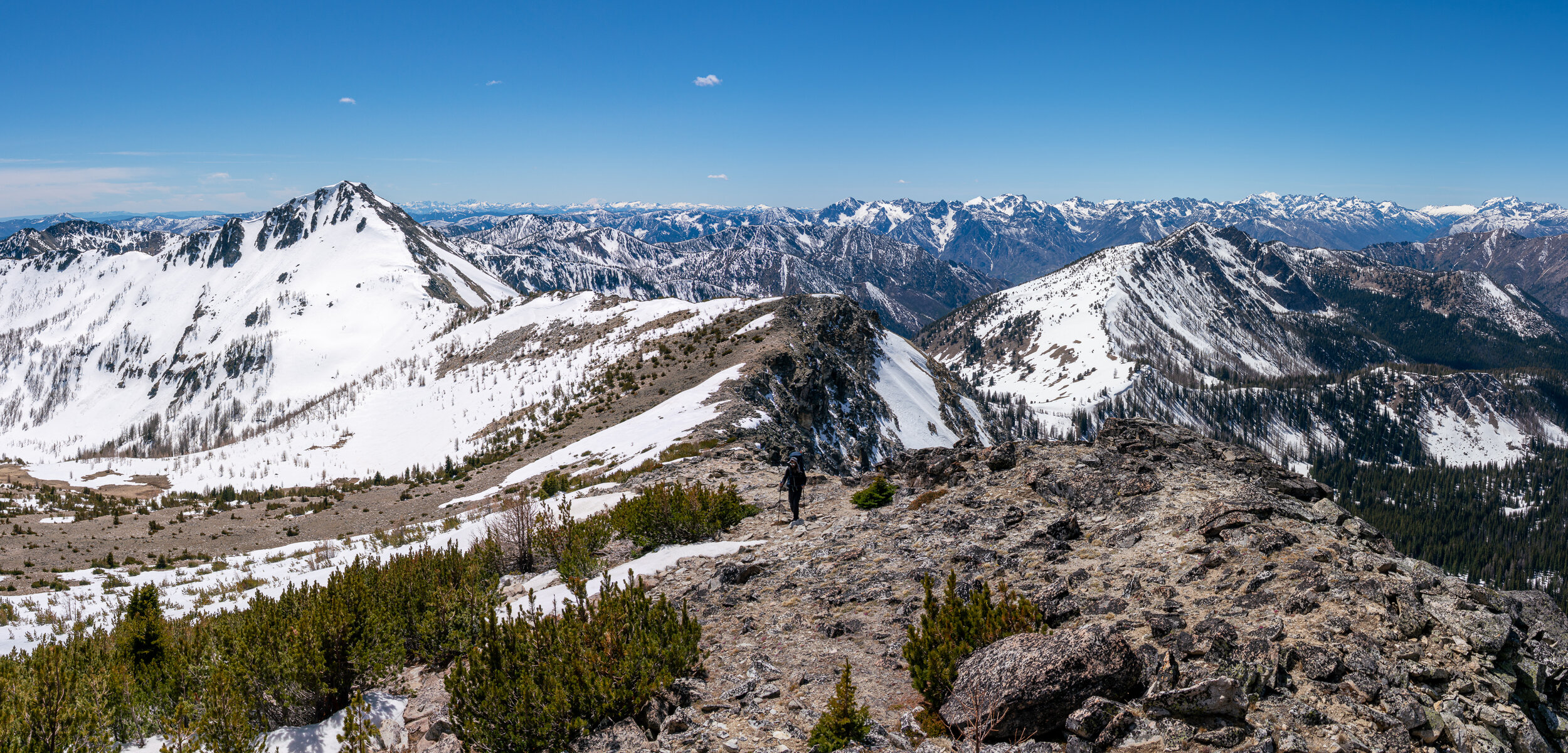
The ridge less traveled
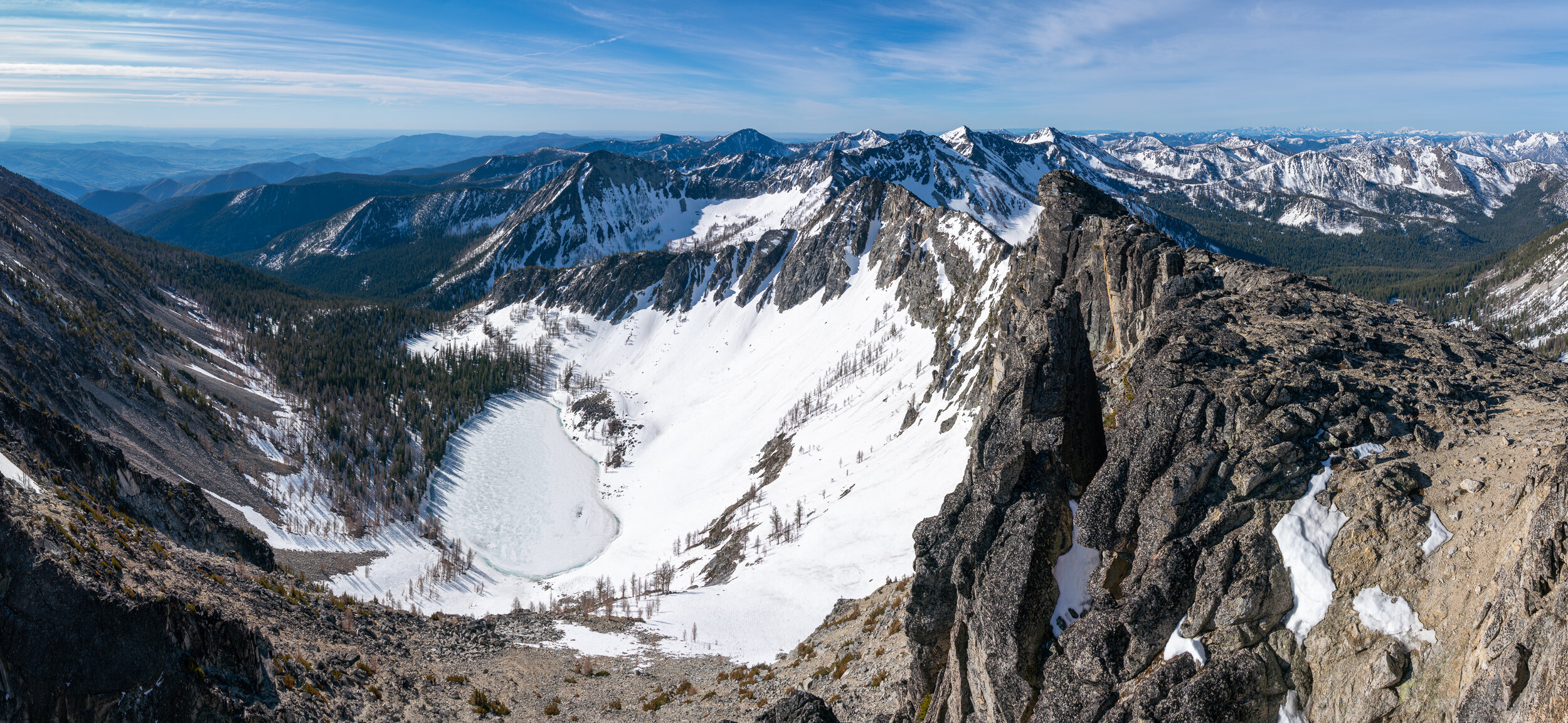
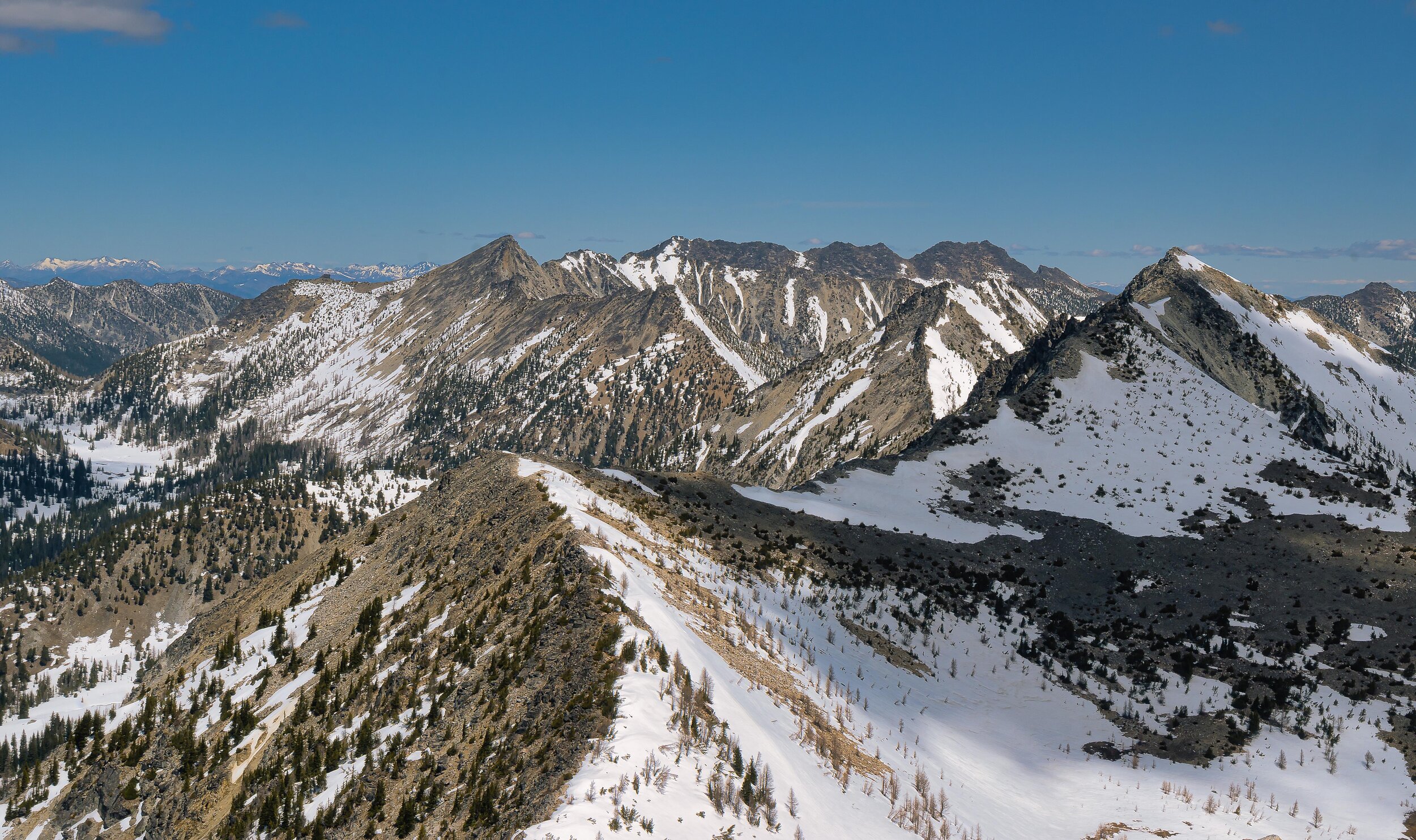
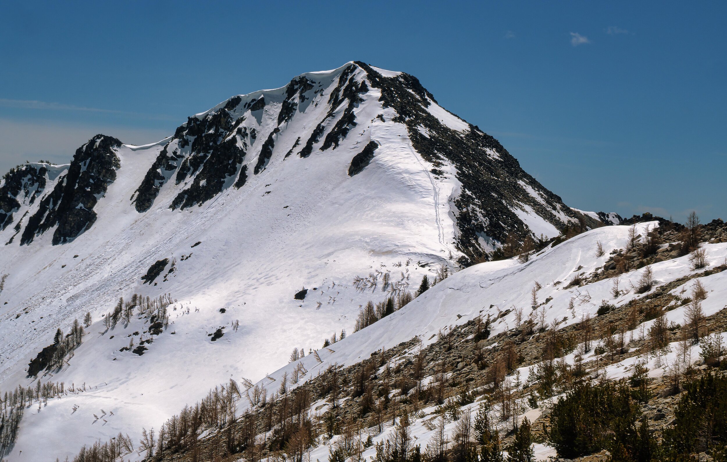
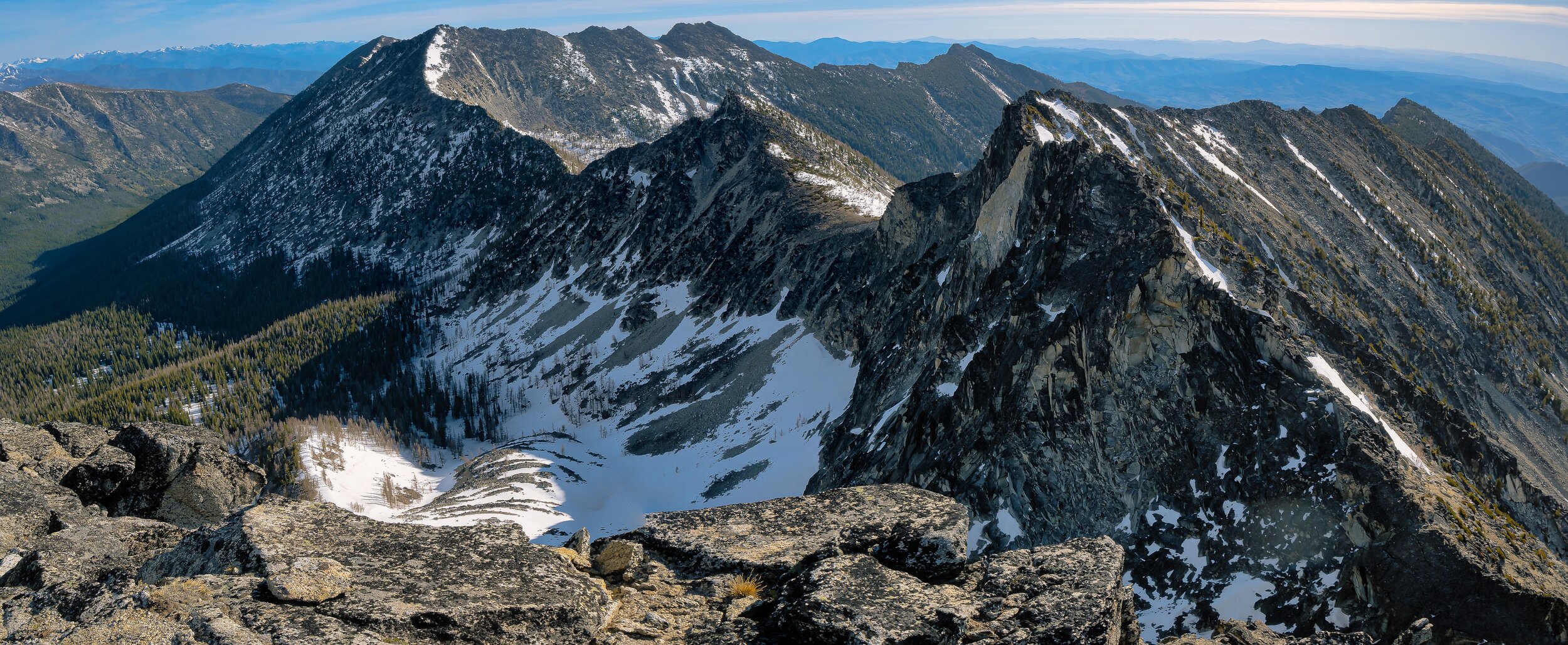
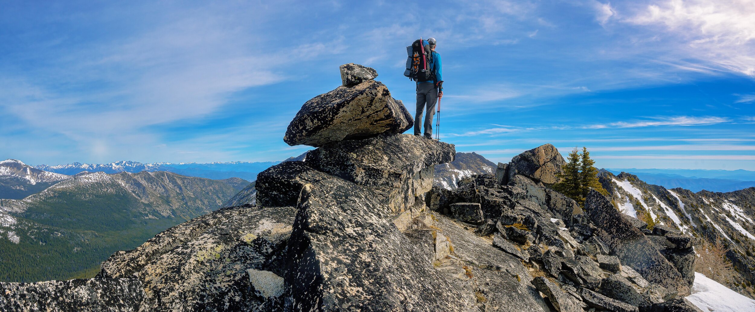
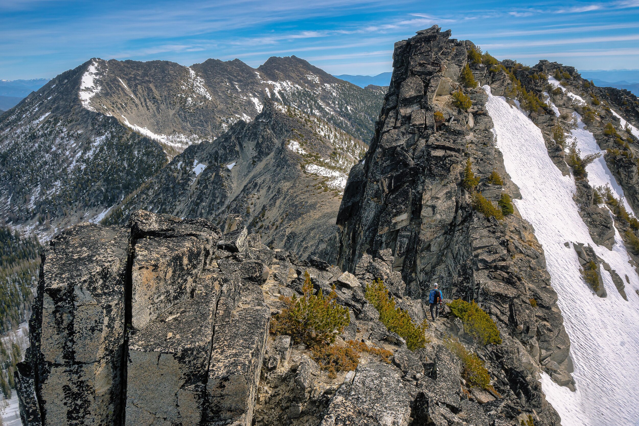
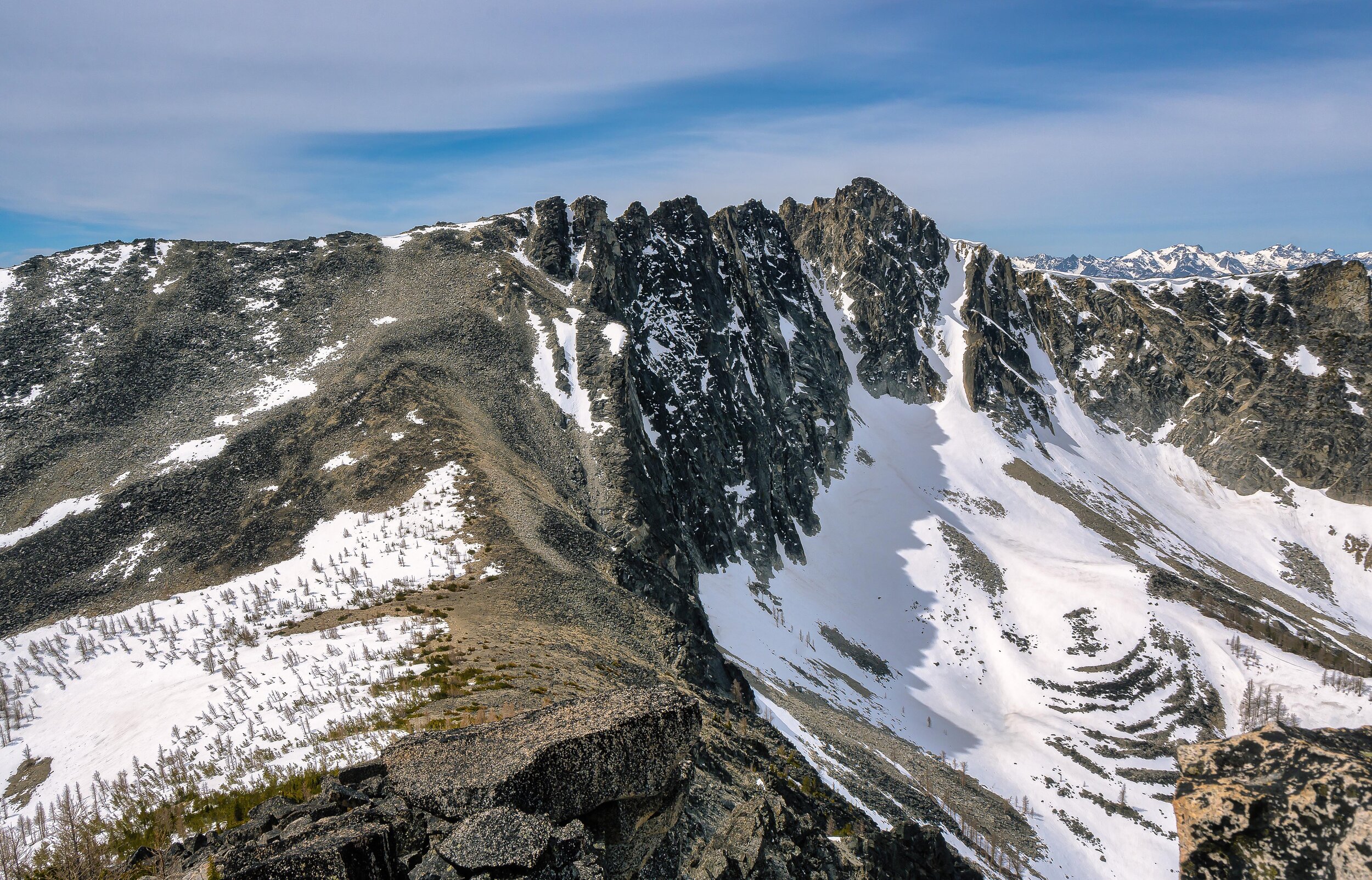
The class 3 route down Bigelow took some route finding, but we found it. Next up was the ridge traverse to point 8356. It was technical terrain, mostly class 3 up and over several high points on the ridge. The rock was solid, and the route finding was fairly straight forward. We went up and over every high point before stopping on the last one labeled 8356 on the topo. Looking back it seemed pretty obvious that one of the other points on the ridge was the true high point. The scramble from Bigelow to 8356 was my favorite part of the trip, it was a lot of fun. We descended talus, then scrambled up Crater and got a look at the ridge over to Libby. The ridge is riddled with gendarmes and I knew it wasn't going to be fun trying to stay on the ridge. I spotted a line that went left and bypassed all the gendarmes via a west side traverse, but somehow talked myself into trying a ridge / right side approach. Spoiler alert, it was horrible, but first getting down from Crater was a challenge! It was steep class 3/4 terrain with some tricky route founding complicated by snow on parts of the route, but we found a way. Soon we were on the ridge to Libby. Again, we tried to stay on the ridge or a bit to the right of it and it was awful. Very tedious terrain again complicated by snow. Tons of "oh crap, where do we go now" moments that was giving me route finding fatigue. I was over it. Towards the end I found a way onto the west side past the largest gendarme and it was much much better travel over talus and boulders. We took said talus and boulders all the way up to Libby, arriving at 2:30. It took us a really really long time to get over there, but we still had time for one more peak, Raven Ridge! (Below photos by Aaron Wilson)


Slushy slog back to the car
The traverse over to Raven Ridge wasn't too bad either staying on the ridge or down slope to the south. At some point on the ridge I heard some faint music. I followed my ear and it lead me to a snow melt drip puddle where there were several dripping points onto this tiny puddle, and each drip point had it's own musical note when the drip hit the puddle. It was really cool, a highlight of the trip for sure! Raven Ridge summit was cool, but we were ready to head back to the car. We descended straight down towards Crater Lake and eventually found a boot track leading out. Of course the snow was post hole city the whole way down which sucked, finally getting to melted out trail around the 5700ft mark. We were glad to get back to the car and change out of our wet clothes! The 5 1/2 hour drive back home wasn't as bad as I thought it would be. Great trip! (Below photos by Aaron Wilson)


9 peaks - Switchback, 8086, Martin, Cheops, Bigelow, 8356, Crater, Libby, Raven Ridge
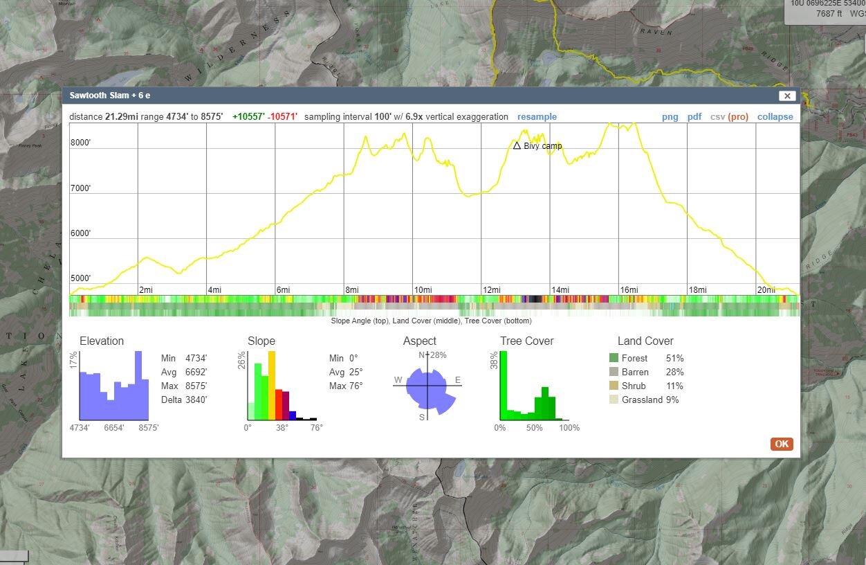
~22 miles and 10,500ft elevation gain (with recorded track sampled into Caltopo)
You can find Aaron Wilson on instagram at @awilsondc.
And for photos of Aaron leading the trip, here’s some of Ross’ shots:


Thanks for reading through this post! @rossjamesphoto and @awilsondc